BASE HEADER
Canalside DPD
1.1 What is a Development Plan Document (DPD)and why is one being prepared for the canals within the district?
National and Local Policy Documents


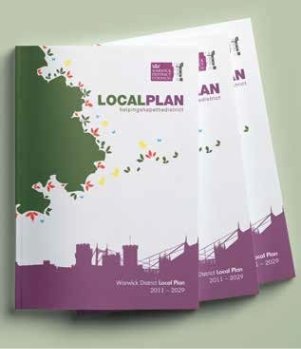
1.2 The district adopted its Local Plan in Sept 2017. The Local Plan sets out the framework for future development in the district; how much, where it will be and how it will be supported in terms of infrastructure. The Plan runs from 2011 to 2029. It contains both allocations for land uses, including housing and employment, and policies by which planning applications will be assessed by development management staff and Planning Committee members. It also provides guidance for developers about what is expected by way of physical, sustainable development and in terms of good design. The Local Plan sits beneath the National Planning Policy framework (NPPF) 2019, document and has to be in conformity with it.
1.3 A DPD is a document that fits within the Local Plan framework, but has been prepared separately as it deals very specifically with a particular aspect or topic. In this case, the canalside has been given special consideration as it is considered that this area has long been neglected in terms of development and promoted for public use and that there are opportunities in this area which could be exploited for the local and wider community.
1.4 There is a policy in the Local Plan (Policy DS17) which commits the Council to undertaking this work.
"The Council will prepare and adopt a Canalside Development Plan Document (DPD) to:
a) assess the canals in the District and their environment and setting;
b) identify areas for regeneration along urban sections, particularly for employment, housing, tourism and cultural uses; and
c) identify areas for protection, where these are appropriate, throughout the canal network within the District.
"This document will designate particular areas and uses and will set out policies for use in assessing planning applications."
"It is on this basis and with reference to each of these criteria that this document has been prepared.
"The text that accompanies this policy in the Local Plan explains why the Council feels that this is an important project.
"The Council wishes to see the canals reach their full potential and provide not only for leisure pursuits but also the possibility of opening up and regenerating areas which have fallen into disuse and been degraded over the years, particularly where this boosts the local economy by providing new jobs. A holistic approach is needed however to avoid piecemeal development which may result in the sterilisation of other sections of the canalside. By carrying out a study into what activity is currently taking place along the canal and within its environs, the Council can plan for a sustainable and productive future. By producing a Development Plan Document the Council will be able to allocate sites specifically for appropriate uses whilst building on and reinforcing existing successful canal side developments, resulting in a vibrant set of proposals to guide future development and contribute to the prosperity of the District."
"Additionally, the Local Plan lists specific locations that the DPD will consider in terms of redevelopment.
"It is intended that this Development Plan Document will also bring forward three of the employment areas (Sydenham Industrial Estate, Cape Road/Millers Road, Montague Road) identified for redevelopment for residential use (see Policy DS8). It is important that proposals for these areas are developed to take account of their canal side location and brought forward as part of the wider uses outlined in this policy".
"As this DPD forms part of the Local Plan, it must be in conformity with both that document and the NPPF.
Neighbourhood Development Plans
1.5 The next level down in the hierarchy of plans is the Neighbourhood Development Plan (NDP). These plans must be in conformity with national and local strategic policies. If a NDP is published for any of the areas adjoining the canalside or including land within the boundary of the DPD, or including the canal itself, then the NDP must be in conformity with all higher levels of policy.
1.6 Objectives of this DPD
- Identify issues and opportunities and address/exploit them
- Look at a wide range of potential schemes to encourage more use of the canals and be imaginative and creative
- Increase the use of the canals and their environs to open them up to a new range of activities
- Create new frontages to face the canals instead of backing onto them, especially with new residential development
- Change perceptions of hidden backwaters as dangerous and crime ridden
- Make the canals safe and attractive and accessible to everyone
- Improve the visual aspects of the canals and widen their appeal to include all sectors of the community
- Protect any aspect of the canal that needs to be preserved whether tangible or conceptual
- Protect wildlife, habitats and water quality
- Increase awareness by use of directional and information boards in appropriate locations
1.7 The Royal; Leamington Spa NDP emerging policies fully support the protection and full utilisation of the local canal network.
Objective 3 A. To protect existing areas of open space, River Leam, Grand Union Canal and other blue infrastructure
Objective 4 E. To utilise the canal and river to attract more visitors, sensitively open up both waterways for better pedestrian/boat/cycle usage
Policy RLS 3
"Conservation areas refers to effect of development on heritage assets and settings, protection of key views and establishing links
Policy RLS 16.
"Canal and Riverside Development. Provides criteria for assessing developments, supports marina on Grand Union Canal with ancillary leisure uses and supports hydropower when in accordance with LP policy, CC2 Planning for Renewable Energy and Low Carbon Generation
Policy RSL18
"Supports improved and new access points to the river and canalsides
1.8 The Extent of This DPD
This document includes the whole length of all the sections of canal that run through the district. It considers not only the canals themselves and the environmental issues surrounding them, such as water quality, but also the land to either side, the state of the towpaths and any facilities that are provided and the land beyond which includes a number of 'opportunity sites', where there is vacant or under-utilised land and/or buildings or other opportunities for regeneration. It also looks at the existing communities, both on the canals and alongside.
Conservation Area
1.9 One of the major pieces of work which has taken place as part of the overall assessment of the canals, is the designation of a new conservation area. An expert in this field surveyed the whole length of the canals in the district to assess the potential for creating this. Additional protection is afforded to land, buildings and the canals which could, for example, help to retain and bring back into use, buildings that are not in themselves worthy of national listing, but nevertheless are special locally in terms of their industrial architecture and importance to the development, demise and resurgence of the canals. Buildings which have local significance should be referred to the district council to assess suitability for inclusion on the local list.
1.10 What criteria are used to judge whether or not to designate a new Conservation Area(s)?
Conservation Areas are 'areas of special architectural or historic interest, the character or appearance of which it is desirable to preserve or enhance' (Planning (Listed Buildings & Conservation Areas) Act, 1990.
1.11 Policies and guidance for Conservation Areas are given by the Government in National Planning Policy Framework, 2019 paras. 184 to 202 and Historic England's Advice Note 1, (second edition) Conservation Area Designation, Appraisal and Management, 2019.
1.12 Local authorities are advised to review their Conservation Areas from time to time and to ensure that they have up to date character appraisals which set out their special interest and provide the basis for development management and enhancement proposals.